What Makes the Main Branch of the Chicago River So Important
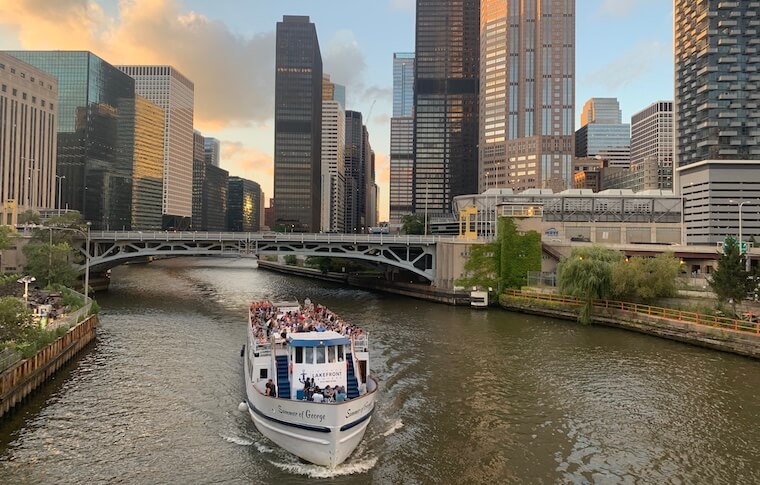
Walk along the Chicago River between Lake Shore Drive and Wolf Point on a clear day, and the city explains itself. The skyline tightens into a canyon of glass, steel, and stone. Bridges tip up for passing masts. Tour boats slide by with microphones crackling. Office workers lean on railings with lunch in hand while joggers dodge strollers, and a barge groans upriver stacked with crushed stone. This short, east to west stretch, the Main Branch, has more to do with how Chicago works, looks, and feels than its length suggests.
A short reach that holds a city together
The Main Branch is barely a mile and a half, starting at the Chicago Harbor Lock and running west to Wolf Point, where the North and South Branches meet. Yet it is the hinge that connects Lake Michigan with the river system that leads to the Mississippi. That connection is literal, through the lock and the canals beyond, and symbolic, as the riverbank bridges Chicago’s mercantile past and its present as a city that markets experience and design. It links navy, freight, public safety, water supply protection, tourism, and daily commuting into one corridor.
Those different uses can clash. Tour boats want smooth traffic. Barges need room to turn. Bridge openings slow cars, cyclists, and buses. After a hard rain, engineers may need to release river water to the lake to keep streets from flooding. The Main Branch is valuable precisely because it concentrates these trade‑offs in a place where they can be managed, seen, and used.
The water that made the city possible
Chicago grew where it did because a marshy portage let people move goods between the Great Lakes and the Mississippi basin. By the 1830s, flatboats and canal plans were already shaping the river mouth. The 1848 Illinois and Michigan Canal formalized the link. But the modern story of the Main Branch begins in 1900, when engineers completed the Chicago Sanitary and Ship Canal and reversed the river’s flow. Instead of carrying waste into Lake Michigan, the river began to run west, drawn by a deeper, manmade channel toward the Des Plaines and Illinois Rivers.
That reversal is still the city’s most audacious piece of civil engineering. It set public health on a different course by protecting the lake, Chicago’s drinking water source, from routine contamination. It also turned the Main Branch into a gateway to the inland waterway network. You can stand at the Michigan Avenue Bridge, watch the river appear to slide inland, and know that beneath the surface, gravity and gates are still doing quiet, crucial work.
Chicago’s Harbor Lock at the river’s mouth, completed in the late 1930s, keeps that separation under control. Lake levels can swing by feet during storms and seasonal changes. The lock lets vessels move between the lake and river while limiting the flow of water. Most days, it is a simple elevator for boats. In extreme weather, it becomes a lever for flood control, and on rare occasions when the river needs relief, operators open gates to the lake in a carefully timed release. The Main Branch, as the lock’s immediate neighbor, is the flexible room in this hydraulic house.
A working artery, not a stage set
Even people who use the Riverwalk every week sometimes forget that the Main Branch is not a park with water in it. It remains a navigable channel with a Coast Guard presence, freight rules, and right of way protocols. You can see the tension in the wake lines. Pleasure craft idle near the walls, tour boats track a smoother centerline, and long, low barges use wide arcs to swing through the bridges.
When the river is crowded in peak summer, boat captains earn their keep. A pontoon boat with the throttle a bit too high and music too loud drifts toward a turning radius a barge cannot change. I have watched a deckhand on a tour boat point subtly toward a better lane, a quick gesture that avoids a horn blast and saves everyone time. The choreography makes the river look easy from the Riverwalk, but it takes skill and an understanding that the Main Branch serves multiple masters.
Commercial traffic on the Main Branch is lighter than it once was, but it has not vanished. Aggregate and scrap still move through. Government and utility boats, from the Metropolitan Water Reclamation District to the Park District, run missions that most people never notice. When lake conditions turn rough, smaller craft duck inside for protection. The river is shelter as well as pathway.
How bridges and streets learned to work with water
The bridge sequence on the Main Branch is dense, and Chicago’s bascule bridges are part of the city’s identity. They are not just pretty. Each one is a moving compromise between waterborne transit and street life. A bridge raised for a mast or a large tow causes a pulse of delays that ripple through traffic signals. A bridge raised too seldom can erode the river’s navigational utility.
The engineering solved a different but related problem at the street level. Wacker Drive, designed in the spirit of the 1909 Plan of Chicago and built in the 1920s, tucks service lanes and loading into a lower deck and preserves the promenade feel on the upper level. It is hard to appreciate until you walk from LaSalle to Michigan and realize delivery trucks do most of their work out of sight. The Main Branch succeeds as a mixed space because city planners gave it room to be both a thoroughfare and a front porch.
Wolf Point, where the city divides and multiplies
Stand at Wolf Point, and you can read the city’s growth like a diagram. The Merch Mart dominates the western view, a reminder that freight and manufacturing once ruled here. The North Branch peels off past River North’s galleries and condos. The South Branch heads through the canyon by Willis Tower toward the railyards and the canal that made the reversal possible. The Main Branch funnels the energy of both streams into the showpiece that tourists know, while still serving these quieter industrial and infrastructural roles.
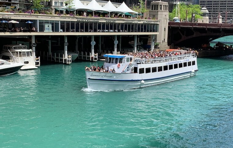
Wolf Point also makes the case for density near water. Recent towers there, for all the debates they sparked, show how much value people assign to a river view in Chicago. Prices follow the curve of the water.
How the Riverwalk changed the conversation
Before the Riverwalk’s modern phases opened between 2015 and 2017, the Main Branch worked, chicago river boats but it did not always welcome. Narrow sidewalks and an awkward grade change between Wacker and the river meant the water was something you glanced at rather than inhabited. The city’s investment filled in missing segments and carved a sequence of purposeful zones.
Designers gave names to those stretches for a reason. The Marina puts seating and cafes at water level, encouraging people to linger. The Cove softens the edge for paddlers and small craft. The River Theater uses large steps as both a gathering place and a way to handle the slope. The Water Plaza is built for kids and heat. The Jetty experiments with floating gardens and habitat structures. The Boardwalk ties it together where the bend makes space tight. Names aside, what matters is that each piece solved a practical need without losing the sightlines and access that draw people in.
That physical work changed behavior. It is now common to see office workers taking calls on the steps, birders scanning pilings for black-crowned night herons, and crews from chicago architecture boat tours pointing at corn cob balconies as Marina City hovers over the water. By putting human legs and eyes at the edge, the Riverwalk forced every other stakeholder to operate with more care. Speeds dropped where they should. Horns gave way to hand signals. The river learned to share itself more visibly.
A museum of architecture that moves
If you are new to Chicago, the quickest way to understand local design culture is to float it. The Main Branch compresses more instructive examples into one ride than most cities manage in a week of walking. It is not just the greatest hits, though you will get the Wrigley Building’s terra cotta, Tribune Tower’s neo-Gothic crown, 333 Wacker’s green curve catching the bend, and the swagger of Marina City’s scalloped parking decks.
The river also reveals how buildings talk to one another across time. Aqua’s rippling balconies, for instance, read differently from the water than from Columbus Drive. From the river, you see how its horizontal motion answers the flat blue plane of the lake, then calms as it meets the tighter canyon further west. The stately setback of the London Guarantee Building feels like a handshake with the Michigan Avenue Bridge. The low industrial remnants west of Wells hint at the days when the river was a workbench rather than a foyer.
Guides on chicago architecture boat tours know these angles by heart. They are storytellers with a movable stage, and the Main Branch supplies the script. On windy days they lean into microphones and time their cadence to the bridges. A good guide can explain why a specific cornice survived a cladding update, or how a plaza setback preserves winter light on the water. If you have lived in the city for years and think you know it, take a ride anyway. New towers arrive, of course, but the river also reveals small cycles, like the way seasonal light picks out a frieze you never noticed from the sidewalk.
A resilient, recovering habitat
For much of the 20th century, the river was defined by what it carried away. That view has softened thanks to better wastewater treatment, disinfection upgrades in the 2010s, and habitat projects along the banks. Water clarity is not tropical by any stretch, but dissolved oxygen and bacterial counts have improved enough to support a wider web of life. Anglers now pull smallmouth bass and channel catfish from the edges. Birders log dozens of species in migration, and the black-crowned night herons that once seemed like a fluke now feel like seasonal residents.
The Jetty segments on the Riverwalk were not window dressing. Floating planters and pocket wetlands give fish shelter from current and predators. Native plants snag runoff, cool the microclimate, and provide perches. It is still an urban river with heavy use, and summer storms can knock water quality down for a day or two. But the Main Branch proves that a waterway can carry boats, delight tourists, and still support genuine ecology when design respects biology.
Public health, flood control, and the quiet work of gates
The river’s reversal was about health as much as navigation, and that legacy still shows up on the Main Branch. Operators use the lock and sluice gates to manage the line where lake and river meet. During heavy rains, especially when soils are saturated, the river can rise rapidly. The underground Tunnel and Reservoir Plan, or Deep Tunnel, captures billions of gallons of stormwater and sewage, buying time. When storage still runs short, the city sometimes opens the lock to release river water into the lake, a choice weighed against the goal of keeping the lake as clean as possible.
Lake Michigan also throws its own punches. Seiches, the inland version of a tide, can push lake water into the river and elevate levels by a foot or more on short notice. Prolonged high lake levels, like those seen a few years ago, stress riverwalls and submerge lower walkways. The Main Branch is the first to feel those shifts and the first to reveal whether investments in wall repair and promenade design were generous enough. Watching city crews adjust bollards, pull power from low outlets, and sandbag vulnerable joints after a storm is a reminder that the river is an engineered system, not simply a view.
Why the St. Patrick’s Day green matters
On one Saturday each March, the Main Branch becomes a stage for a dyeing ritual that draws enormous crowds. The practice started in the early 1960s when plumbers used dye to trace illegal sewage connections and realized the spectacle it created. Today’s formula uses vegetable-based dye, applied from small boats that arc back and forth to create a uniform ribbon of neon green that lasts for roughly a day. It is not chemistry theater only. The tradition cements a civic relationship to the water and forces public agencies to plan crowd management, boat traffic, and emergency access months in advance. The dyeing, for all its party vibe, marks the river as a shared asset that requires coordination and respect.
A classroom for planners and a test track for trade‑offs
Urban planners bring students to the Main Branch because it compresses lessons into view. You can see how a two-level roadway takes service traffic off the promenade, how step-down seating doubles as floodable infrastructure, and how mixed uses can coexist when rules are clear and enforcement has teeth. The river teaches softer lessons too. Most days, the people using it enforce norms of graciousness with eye contact and small gestures. That self-regulation breaks down in specific conditions, like Saturday afternoons in July when too many rentals and too much alcohol combine with low skill levels. The river then reminds everyone why licensing, wake limits, and defined traffic lanes exist.
A good example of a trade‑off is the debate over new docks and restaurants. More activation draws people and dollars but creates more conflict points with passing boats and rescue access. Design details matter. Short spans of railing that swing open for emergency use can be the difference between a quick response and a rescue hampered by furniture and planters.
Economic engine, from offices to oars
Real estate along the Main Branch commands a premium. That premium filters through construction jobs, restaurant payrolls, and tour operations. The river is also an employment channel that is not always obvious. Tour crews, lock operators, bridge tenders, marine mechanics, and wastewater technicians all work this corridor. Their shifts run early to late, through summer storms and winter freezes, keeping everything synchronized.
Recreation layers on top without being frivolous. Kayak rentals have to teach river etiquette quickly and well. Rowers from local clubs sometimes appear in the early light, long shells skimming under the bridges before the first tour boats start boarding. On warm evenings, the Riverwalk becomes an outdoor living room for thousands of people, most of whom arrived on foot or by transit. That foot traffic changes how adjacent streets feel and supports businesses that used to struggle after 5 p.m.
How to see it well
If you care about design, take a boat, then walk, then ride a bus across a few bridges. Each vantage point rewrites the river.
-
Best overviews: a morning cruise from the lake through the lock gives crisp light on east facing facades, while a late afternoon ride westward toward Wolf Point pulls out textures and relief. Walking from Columbus to LaSalle at mid height on the Riverwalk reveals the way stairs and ramps manage slope without killing momentum. Bridges at State and Dearborn provide framed street to river views that anchor photos without distortion.
-
Practical tips for boat days: check the weather and wind on the lake, because a small craft advisory can shift boats to the river and make traffic denser. Seats on the port side pick up different facades depending on the route; ask crew which side to favor based on the day’s path. On busy Saturdays, downtown dock queues can stack up; weekday morning trips often feel calmer and sharper for photos. If you are with family, watch for wet seats near the bow after lock cycles.
For anyone curious about chicago architecture boat tours, many operators run year round, weather permitting, though most traffic centers from April through November. Docents trained by local foundations deliver deeper history, while private charters tilt toward social outings. Both work. Choose one that runs the full Main Branch and at least a short turn onto one of the branches, so you can compare the open feeling near the lake to the tighter canyons upriver.
History that still affects daily life
The Great Chicago Fire of 1871 crossed the river because floating debris and oil slicks created fire paths that no water barrier could stop. Chemical spills and lax practices continued to plague the river into the mid 20th century. Those memories shape present rules. chicago architectural boat tour Fueling happens with strict controls. Debris skimming is routine, not occasional. Bridge houses that look quaint still hold serious equipment, and their operators train for scenarios most of us never imagine.
Fort Dearborn once sat by the mouth. The Main Branch has, in a sense, been the city’s front door since the early 1800s. That heritage gives weight to small design choices, like the color of a rail, the slope of a seat, or the decision to keep sightlines under a certain bridge clear. When every visitor in a new office tower walks past the water at lunchtime, those details influence whether the river feels like a place for everyone or a platform for curated experiences alone.
The lake, the lock, and the line you cannot see
People sometimes ask whether the river is still reversed, as if it might have quietly shifted back. The answer plays out in tiny signs. Look at the way debris tracks in light wind and the direction of flow at outfalls. Watch the lock cycles and the coordinated opening of gates. Speak with a crew member, and they will describe a system that is mostly steady westward, with pulses and adjustments driven by storms and navigation needs.
The lock is the Main Branch’s heartbeat. When it runs smoothly, no one notices. When it pauses for maintenance or a late season surge, the city adjusts. Freight waits. Tours reschedule. Kayaks stay upstream. The elegance of the structure is that it allows these shifts without drama most of the time. It is hard to imagine a more crucial piece of infrastructure that lives so publicly and quietly in plain sight.
What the Main Branch teaches other cities
Plenty of places have revitalized waterfronts, but Chicago’s Main Branch offers some uncommon lessons. It shows that you can keep a river working and make it welcoming without faking either purpose. It shows that beauty can come from function, like the heavy flanks of a bascule bridge or the honest curve of a floodable stair. It also shows the risk of success. Crowds make money and energy, but they also create fragility. A single poor design choice, like a railing that blocks rescue access, or a lax enforcement season, can cascade into real harm.
The future of the Main Branch will test these lessons further. Climate volatility means wider swings in lake level, more intense downpours, and longer heat waves. Materials will need to age well in a wet freeze and thaw cycle. Plantings will need to handle flood, drought, and salt. New buildings will rise, and their edges will either add to the river’s dialog or talk over it. The good news is that the Main Branch has a habit of absorbing change chicago boat tour and improving anyway, because the water shapes designers as much as they shape it.
Why it matters beyond the postcard
Chicago would still be a city without the Main Branch, but it would not be this city. The waterway binds civic identity to practical need. It is where public health engineering solved a crisis, where navigation meets skyline, where pedestrians can hear a barge chain rattle and a soprano sax solo drift out of an underbridge all in the same afternoon. The river asks people to share space, to slow down for a raised bridge, to shift a path because a line of kayaks needs the wall. That daily choreography weaves patience into a metropolis that prides itself on momentum.
If you live here, the Main Branch is a measure of how well the city takes care of itself. If you visit, it is a quick way to understand what Chicago values. Take the stairs down. Watch a bridge lift. Listen to a deckhand caution a jet ski rider with a raised palm instead of a shout. Then look west, past the corn cobs and the green glass, to the split at Wolf Point. That is the spot where the water divides, the skyline shifts, and Chicago’s overlapping purposes reveal themselves.
Tours & Boats Architecture Tours 900 S Wells St Chicago, IL 60607 ph: (312) 858-6955 https://toursandboats.com